Full reference: Bodóczi A., Pintye B., Kciuk M. (2025). Precise laser scanning for floor flatness: Methodology and applications for surveying, registration, and analytics
Surveying Floor Surface Regularity: Then and Now
In construction, errors in the geometry of built components can significantly affect both the progress of construction stages and the performance of the completed structure. As such, geometric tolerance control, especially during early phases such as slab construction, is essential to ensure long-term integrity and functionality.
Critical aspects of this control are surface flatness, and levelness which together define Surface Regularity (SR) as the deviation of a floor’s actual surface from a theoretical flat plane. While SR assessments may apply to various orientations and materials, they are most commonly associated with concrete floors and screeds.
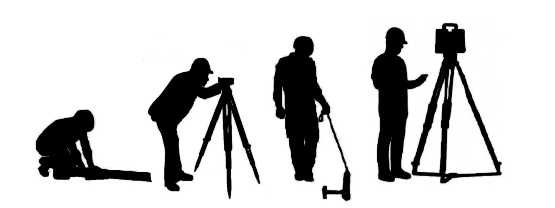
Traditionally straightedges and optical levelling have been employed for SR assessment of floors. The former uses a long straightedge – usually between 2 to 3 meters, depending on the local requirements (e.g. in British Standards’ BS 8204-1:2003 a 2m straightedge is used) – which is placed at various points on the floor and measuring the deviation beneath it, often using a stainless-steel slip gauge. Optical levelling involves the use of a level instrument set up on a tripod, through which the surveyor reads graduated staff measurements placed on points of interest. While simple, relatively accurate and cheap, these methods are plagued by limitations, such as its low positional precision, poor repeatability, and impracticality over large floor areas.
In the late 1970’s as an improvement to the straightedge, floor profiling systems (or F-Number System) - with dipsticks and profilographs - were introduced to offer more objective and standardized measurements, accounting for both flatness and levelness. Though more effective than the straightedge method, floor profilers require extensive manual data collection, most often walking the devices over the floor, combined with optical levelling for levelness assessment ,still including human-operated measurement routines that remain labour-intensive and error-prone.
Terrestrial Laser Scanning (TLS) has its origins in the technological advancements of the 1960s utilizing lights, cameras, and projectors to capture the surfaces of objects. These early systems were limited by the technology of the time, often requiring significant effort to produce accurate scans. The late 1990s and early 2000s saw TLS technology transition from research and development into practical applications across various industries. Developments in computing power, data storage, software and algorithms facilitated the processing of large point cloud datasets, made laser scanners the most viable tools for detailed spatial measurements by today. TLS offers automated, high-resolution, three-dimensional surface data collection that dramatically enhances the efficiency and accuracy of flatness assessments. With laser scanning, time and accuracy are no longer in conflict - surveyors can collect detailed data rapidly over large areas, reducing both manual labour and subjectivity.